
Single Shot
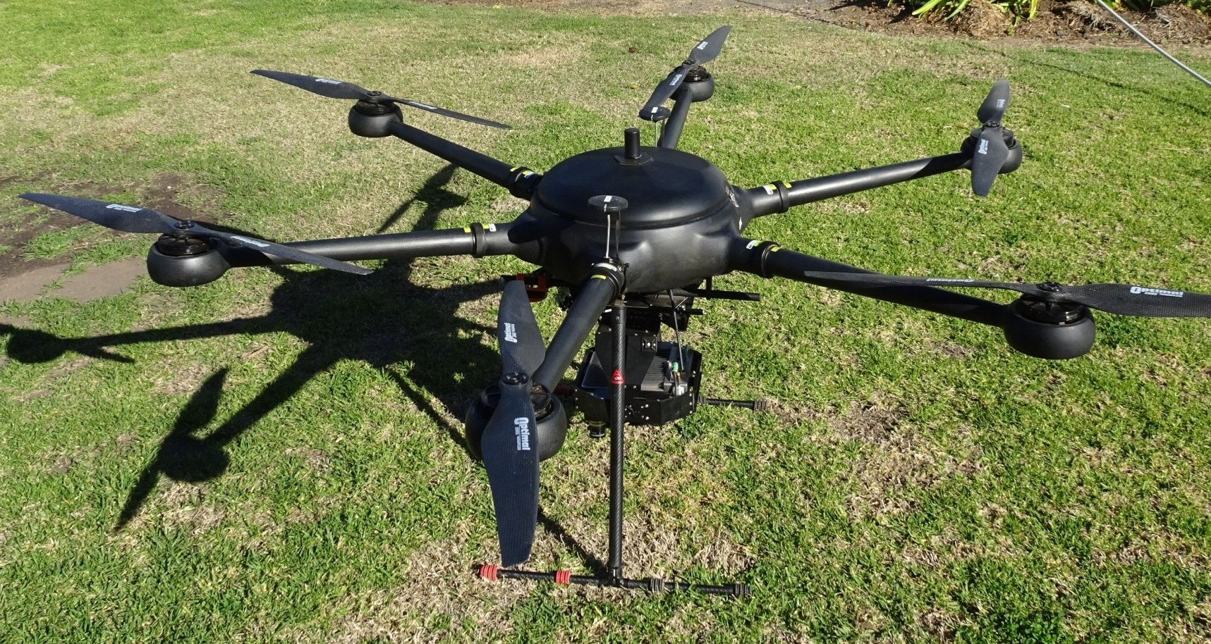
Drone Weed Mapping Technology
Revolutionary Weed Control Technology
Drone weed mapping for spot spraying: Know what’s there before you spray – consistent weed detection driving down the weed seed bank.
Spot spraying is fast becoming a cornerstone of our integrated weed management program. The ability to legally use spot-spray registrations and rates ensures effective weed kills, minimising the use of sub-lethal broadacre rates on hard to kill weeds.
This is possible due to the highly accurate and consistent weed detection by Single Shot. Escapes are minimised and the area to be sprayed is assessed prior to application, a legal requirement for many labels.
Single Shot is poised to completely overhaul your selective spot spraying application.
Controlling and eliminating herbicide resistant plants is all about a planned approach using various methods of weed control. Weed maps provides the platform for this to occur.
Controlling weeds that have escaped from a herbicide application at very low numbers is vital to the continued effective use of herbicides in the agricultural industry. In fallows, the aim must be to stop every weed from setting seed. Single Shot provides the tool to do just that effectively and at minimal expense. It is for this reason that many in the industry regard green on brown weed mapping as far more important than green on green weed control. Green on brown weed maps will play a vital role in containing herbicide resistance in a cost-effective manner in any situation where chemical fallows are used around the world.
As opposed to existing green on brown optical spot sprayers, the Single Shot system creates the weed map as a separate operation, before you spot-spray the weeds. It is capable of mapping 200 hectares an hour, consistently picking up weeds as little as 4cm in size and, because it operates vertically above the paddock, it detects weeds in stubble easily. The sensor mounted to the drone identifies green on brown and subsequently produces a weed map - a series of shape files, directly useable by spray controllers. The information is then processed locally with minimal uploads/downloads to the Internet, allowing production of a weed map the same day.
These weed maps can then be loaded into any compatible GPS section-controlled sprayer, allowing cost effective spot spraying without the need for a dedicated optical sprayer. A "hole" in the shapefile indicates a weed has been detected at that exact location. The spray controller then does its job by activating the corresponding section of the boom as the sprayer passes over that location.
Read more about how Single Shot is working on the Single family farm.
- Weedsmart Case study 1
- Weedsmart Case study 2
- GRDC Update News Article
- Queensland Country Life: Air-borne weed detector helps map out weed control at Coonamble
- Farm Weekly: New approach with airborne weed sensor

Single Shot System Process
PLAN
- Plan the flights using standard software - only required to be completed initially.
- The software uses satellite imagery and can be planned from an office.
SETUP
- Assemble the Drone.
- Setup and turn on base station or ensure access to alternate RINEX data.
- Upload flight plan to the Drone.
FLY
- Fly the planned area with the sensor automatically logging as required.
- User swaps out batteries and storage devices as required at the end of each flight.
- 40-minute flight duration per battery set.
PROCESS
- Processing can start about 2 hours after the ending of the first flight in the field.
- GPS and IMU data are required to be uploaded (requires 4G internet connection).
- Requires a standard Windows 10 laptop with Single Shot software.
SPRAY
- Images are processed at approximately 250Ha/ hour locally.
- Files are uploaded to the spray controller and are ready to use immediately.
Benefits - The Sky's the Limit
- Match or out-perform existing boom mounted technology in weed identification and less false positives with application via GPS controlled sprayers.
- Per hour of application, Single Shot will map an area approximately 3.3 times faster than a 36m boom mounted optical sprayer,
- Capital cost is a fraction of dedicated boom mounted optical sprayers.
- Quality control is easy by simply scouting for escaped weeds after a spot spray application has been identified and sprayed, especially given that these weeds may be herbicide resistant.
- A double knockdown application can be applied to browned out weeds after an initial spot spray application by using the same weed map.
- Has the ability to target weeds by size and, where a blanket application is required, larger weeds could receive a heavier rate of herbicide or a different herbicide, however individual weeds growing in clumps would be seen as a large weed.
- Fields flown before or shortly after a rain event would result in weed maps excluding the germination from that rain event but spot spraying on the earlier weeds requiring a higher rate or different herbicide could be incorporated with a blanket spray through prescription mapping or a separate spray line.
- Where a weed is identified, a radius around that weed can be built into the weed map which reflects where seeds have fallen from that plant, which would allow:
a. Very small undetectable weeds to be sprayed in the process of spraying the larger weed and/or
b. For pre-emergent herbicides to be selectively applied. - Weed maps over a season can be accumulated together to provide a seasonal map, which can then be used to selectively apply pre-emergent herbicides before the next season’s weeds germinate.
- Fields can be scouted for isolated weeds that may have escaped a blanket application, especially as it is probable that these weeds are herbicide resistant and can be controlled before they become significant problems.
- In row crops, weeds growing out of place can be identified and treated.
- Weed maps could be used to trigger alternative selective weed control, for example, mechanical where tynes selectively engage the ground or microwave weed control.